During my recent reading of London Falling, I wondered how quickly
someone might get from the Boleyn Ground at Upton Park to the M25.
As part of the GPS tracking project, I had already written code
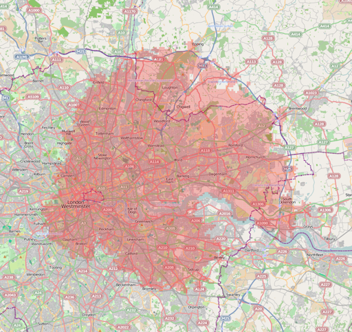
that could help find out; here's a shaded areas showing what's within
a nominal fifteen minutes' travel from that spot.

It's not perfect - it uses routino to
search for a route to the centre of each grid square (thus not
particularly allowing for traffic), and if a main road only runs
through the square and doesn't touch the centre it won't be filled in.
Thus the gaps along the M11. It looks as though going straight out
along the A13 would be the best bet (as far as I remember it's dual
carriageway and minimal traffic lights all the way from Canning Town),
with the A12, M11 and even the A10 as plausible alternatives, but the
M1 is out of the question.
Comments on this post are now closed. If you have particular grounds for adding a late comment, comment on a more recent post quoting the URL of this one.