I don't like being spied on. But I don't mind gathering my own data.
In July of 2012 I bought a USB GPS receiver (a GlobalSat BU-353, the
cheapest available device that had a good score on the gpsd
compatibility list) for use with a Raspberry Pi, and I have it running
for most car trips I make. (Images follow.)
The Pi is plugged into a cigar-lighter power adaptor (my car has
an extra socket in the boot, which is handy for this) and a very
simple piece of software records the raw output of gpsd to a file on
the Pi's SSD: it's a series of lines of JSON. That can later be
interpreted and overlaid onto maps; here I'm using OpenStreetMap
Mapnik tiles.
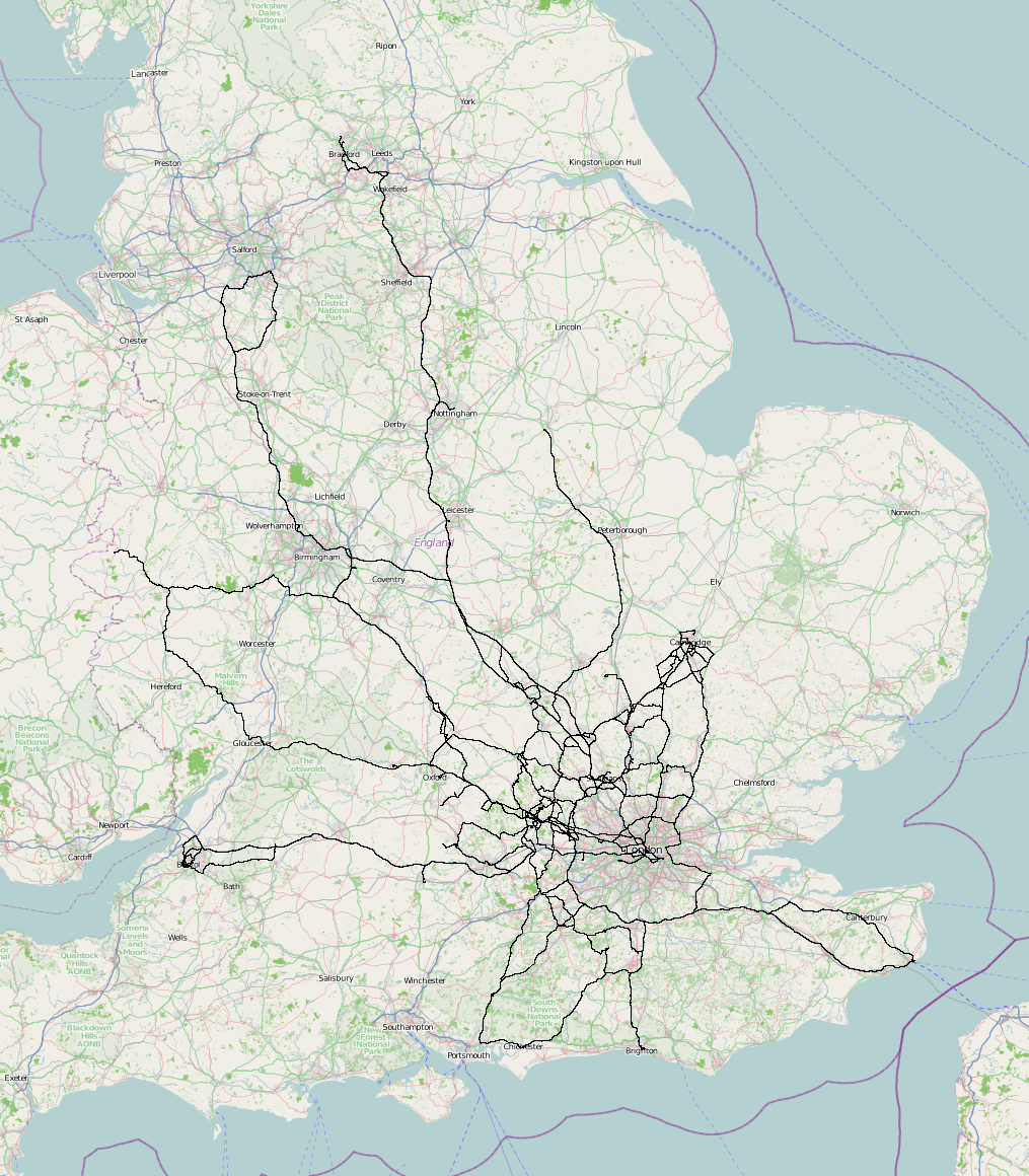
So here's the map of the domestic car journeys for which I have logs.

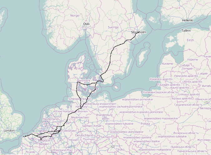
And here's the foreign version.

Which is an interesting start. But there's much more that's possible.
Every data point has a time and speed attached.
Here's a really simple example to get started with. Consider those two
routes round Denmark in the foreign map above: they diverge around
Hamburg in the south, and a few miles outside Copenhagen in the north.
The land route (north through Denmark and a sharp right turn) took
4:25:46; the ferry route took 4:52:46. (Both of these include breaks,
of course.) As far as mileage goes, the land route is about 283
driving miles, while the ferry route is about 199.
So I can now make an informed decision: is it worth saving 84 miles of
driving (fuel, car wear, etc.) to pay 80-plus pounds for the ferry and
take half an hour longer? Well, no.
Even though the Danish Ministry of Transport would like one to use the
ferry route (I've been asked in a lay-by why we were using the road
rather than the nice ferry), from this data point it seems better not
to.
Comments on this post are now closed. If you have particular grounds for adding a late comment, comment on a more recent post quoting the URL of this one.