Pretty much every Wednesday evening, I drive to Cambridge and back.
Since I leave at about the same time, I have some fairly consistent
data about traffic patterns. (Images follow.)
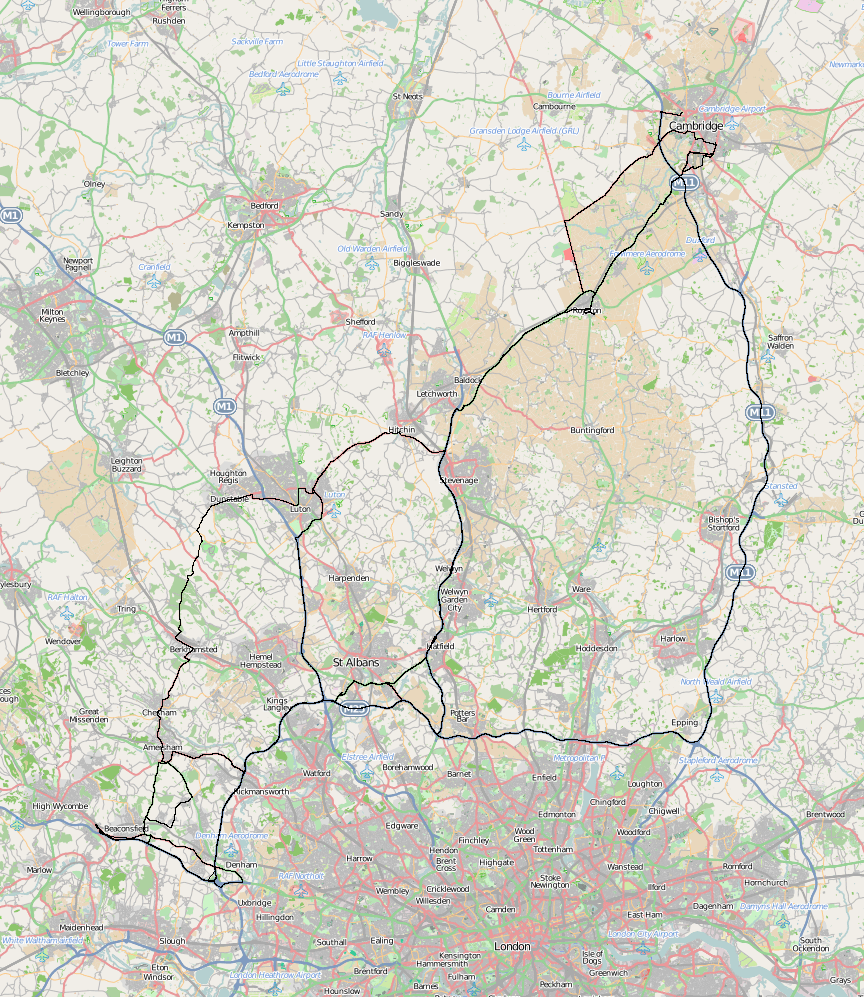
Here's the map of all the routes I've taken, outbound. In fact
the A1(M) (via Welwyn Garden City) is the one I almost always use; all
that messing about through Berkhamstead only happens when things are
really slow elsewhere.

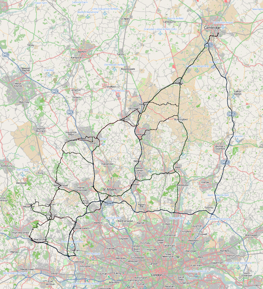
These are the home-bound routes. I diverge more: there's less of a
deadline, there are more likely to be roadworks on the major route,
and sometimes I divert to make a Freecycle pickup.

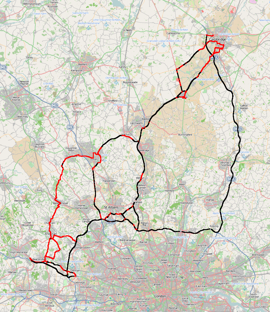
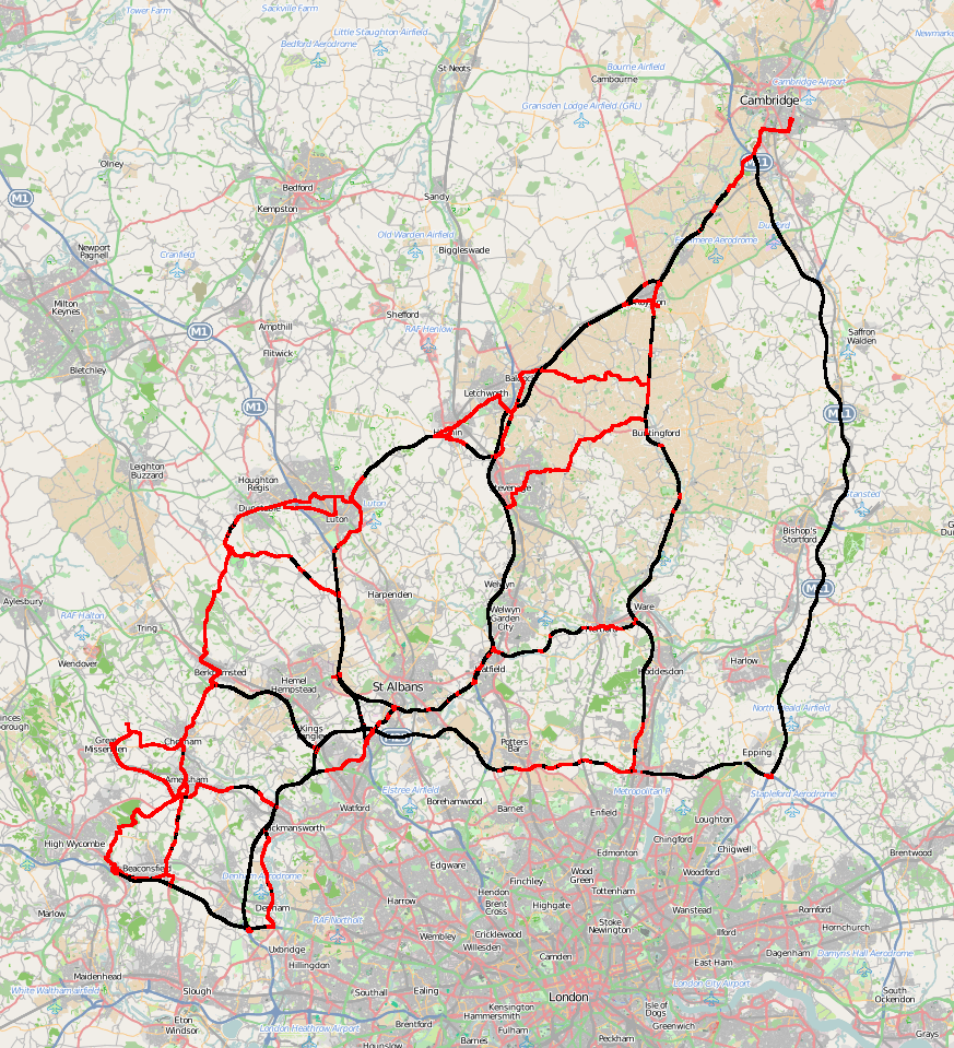
But I can get more information out of these data. Here, for each pixel
on the map, I paint it black if my average speed while in that pixel
was over 50mph and red if it was less (then expand the pixels to 3x3
squares to make them easier to see).
Obviously most of the urban areas are slow, as well as junctions, but
that spot just north of Welwyn Garden City is distinctive: it's where
the carriageway narrows from three to two lanes, and there's almost
always a traffic jam on the outbound route.

On the way back, the cross-country experiments become much clearer, as
well as the speed restrictions on the A10 (south from Royston to
Buntingford and Ware), which is why I don't often use it.

Comments on this post are now closed. If you have particular grounds for adding a late comment, comment on a more recent post quoting the URL of this one.