More panic and despondency in Marlow. The waters today were higher
than on either of our previous visits.
All images are cc-by-sa.
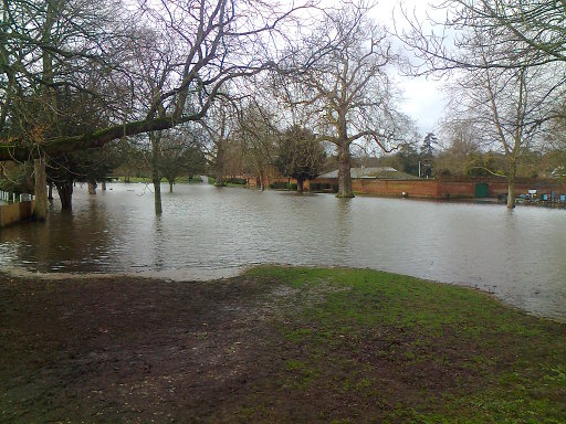
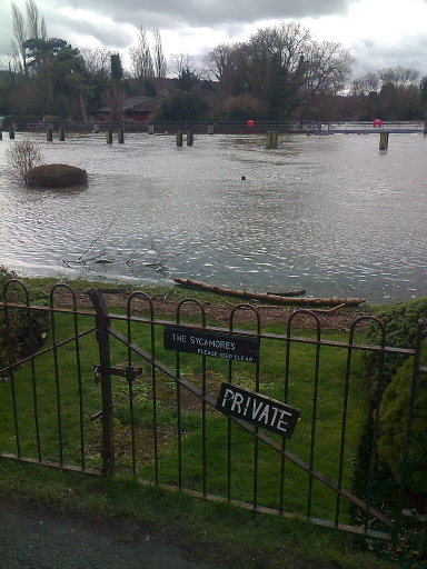
The park was officially closed: no mud-larking today.
The Thames Path was thoroughly underwater. (That's the inner fence;
the outer one is entirely submerged, just about visible below the
water.)
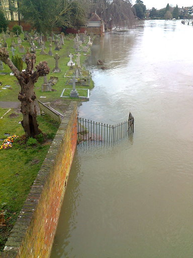
Looking downstream from the bridge, "phew, it's not quite to the
graves"... except there are at least two tiers of gravestones that
are submerged already. The river was flowing vigorously.
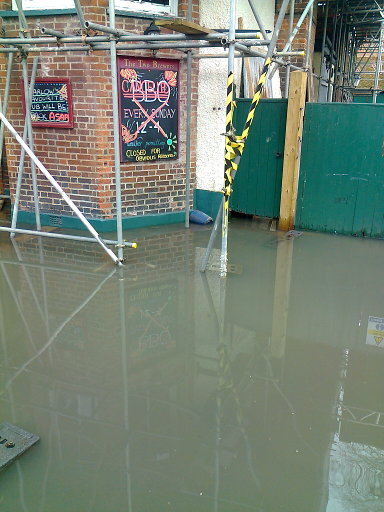
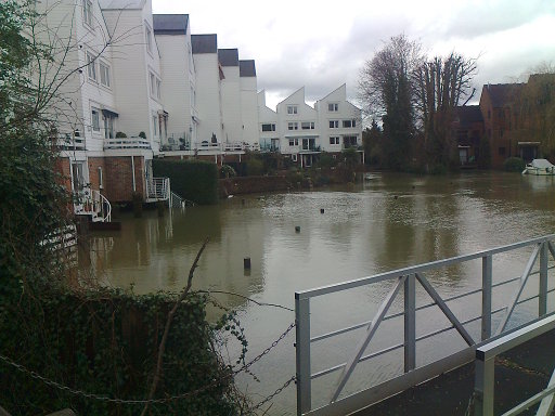
The Two Brewers on St Peter's Street, The barbecue has been cancelled.
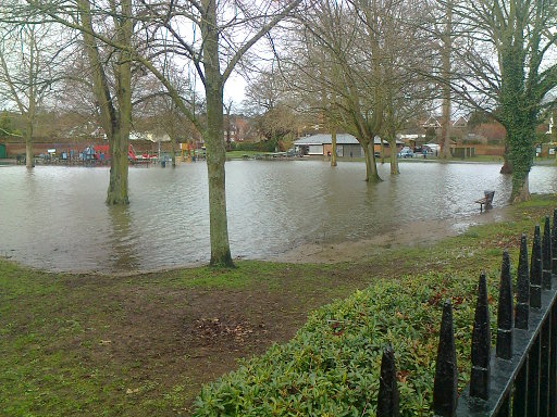
There's about twice as much lawn below water as you can see here above
it. Compare the "top of flood" picture from last time.
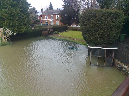
The pampas is an island again, and the ducks have abandoned their
perch on the edge of the lawn. If you look closely down and left from
the lawn chairs, you can see a light square patch: that's the capstone
at the end of the wall.
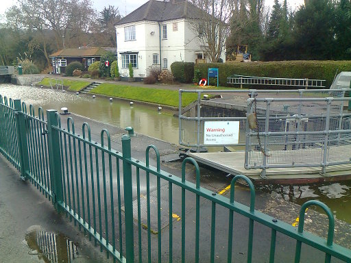
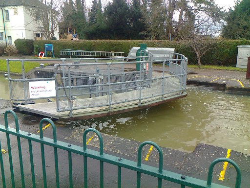
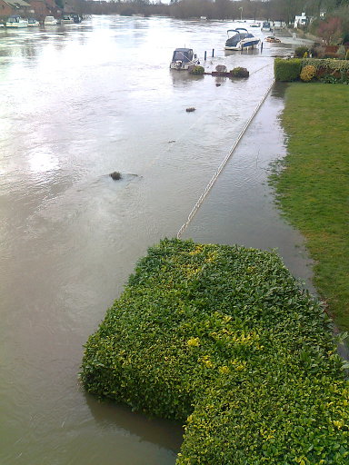
Marlow Lock itself. The bollards are definitely flooded now; that's
9-12 inches higher than the first time we visited.
The back of the nasty flats. That fountain, or whatever it is, is
still going. Perhaps the owners are away?
There was only about a two foot drop over the weir. While the river
above is flowing vigorously, the river below isn't draining anything
like as well as one might expect.
- Posted by Michael Cule at
06:20pm on
11 February 2014
There are flood warnings in Wycombe too but I feel safe enough: the Wye will flood onto the park first and not in my direction. It would take quite Biblical flooding to reach me.
But there's also a warning along the Hughenden valley which might be more serious for the houses built on the flood plane there. I'll bring you a report when I see you on Thursday as that's my day for hitting Morrison's fish counter.
- Posted by RogerBW at
06:41pm on
11 February 2014
It was not by coincidence that when we moved here we picked a spot most of the way up a hill. The bastards won't stop draining water-meadows to put houses where they used to be, and I expect more floods to come.
- Posted by Owen Smith at
01:50am on
12 February 2014
Milton where I live was inhabited back in Roman times. It is built on what passes for a very slight rise in the fens, and if flooding hits the Cam there is an awful lot of stuff between me and the river that will be flooded first. However if the Cam does flood I expect Waterbeach railway station car park to be under several feet of water again. There's a hint in the name, it's not called Waterbeach for nothing (contrasted with Landbeach up the road).
- Posted by Owen Smith at
02:00am on
12 February 2014
My parents live in Holmfirth. One year the house insurance renewal questioned how far it was from the small river, the chap on the phone suggesting it might be within 100m. "Is that horizontally or vertically?" my dad replied. The chap said "Ah yes there are a lot of contour lines between you and the river". Incredibly the form only cares about how far you are horizontally from the river, assuming all land is virtually flat. So the chap just put down that no it wasn't within 100m. Many of the houses near my parents are two stories high at the front and three or four stories high at the back, that's how steel the land is.
- Posted by RogerBW at
09:43am on
12 February 2014
Considering how much of the Fen country was simply underwater until they got the Dutch engineers in to fix it in the 1800s, it's hardly surprising...
I think we're something like 400 feet from the river here, but also around 50 feet up.
I assume people are familiar with the Flood Maps site at Firetree? I used it in the Reign of Steel games. It uses DEM data to predict areas of inundation based on set amounts of sea level rise: a crude model since it can't take water flow patterns into account, but still interesting. At +7 metres, Cambridge is a coastal town at the end of Wisbech Bay.
- Posted by Owen Smith at
12:51pm on
12 February 2014
Your 7m sea level rise map actually shows Milton remains above water, just. We're right on the edge. And it's fun scrolling through the fens and noting that most of the islands where the land rises have a small village or town on them. The fens were drained recently enough that most of the building continues to be on the higher ground, peat shrinakge around here makes it obvious what is going to happen one day.
Comments on this post are now closed. If you have particular grounds for adding a late comment, comment on a more recent post quoting the URL of this one.